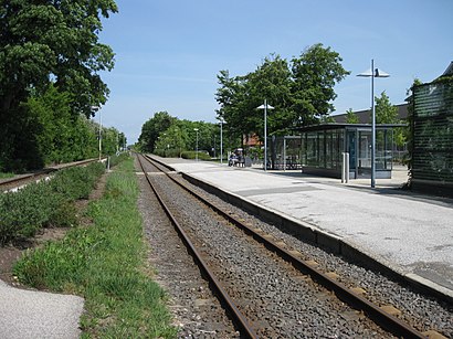
Tistrup St. stop - Tuesday schedule
| Line | Direction | Time |
|---|---|---|
| 475 | Sig Vardevej V Vesterbækvej (Varde) | 6:53 AM |
| 475 | Tistrup St. (Bus) | 7:44 AM |
| 475 | Varde Rutebilstation | 9:09 AM |
| 473 | Tistrup Skole | 1:44 PM |
| 475 | Sig Vardevej V Vesterbækvej (Varde) | 2:12 PM |
| 473 | Tistrup Skole | 2:38 PM |
| 475 | Sig Vardevej V Vesterbækvej (Varde) | 2:47 PM |
| 473 | Tistrup Skole | 3:40 PM |
| 475 | Tistrup St. (Bus) | 3:42 PM |
Directions to Tistrup St. stop (Varde) with public transit
The following transit lines have routes that pass near Tistrup St.
 Bus: 2572, 473, 474, 475.
- Train: 030.
How to get to Tistrup St. stop by bus?
Click on the bus route to see step by step directions with maps, line arrival times and updated time schedules.
How to get to Tistrup St. stop by train?
Click on the train route to see step by step directions with maps, line arrival times and updated time schedules.
Bus stops near Tistrup St. stop in Varde
- Tistrup Skole, 11 min walk,
Bus lines to Tistrup St. stop in Varde
- 2572, Ølgod Svømmehal,
- 473, Lindbjerg Skole (Ølgod) - Tistrup Skole,
- 474, Tistrup Skole - Ølgodvej v Sdr Bjalderupvej (Ølgod),
- 475, Tistrup St. - Varde Rutebilstation,
What are the closest stations to Tistrup St.?
The closest stations to Tistrup St. are:
- Tistrup Skole is 853 meters away, 11 min walk.
Which bus line stops near Tistrup St.?
2572 (Tistrup Skole)
Which train line stops near Tistrup St.?
030 (Skjern St.)
What’s the nearest bus station to Tistrup St. in Varde?
The nearest bus station to Tistrup St. in Varde is Tistrup Skole. It’s a 11 min walk away.
See Tistrup St. stop, Varde, on the map
Public transit to Tistrup St. stop in Varde
Looking for directions to Tistrup St. in Varde, Denmark?
Download the Moovit App to find the current schedule and step-by-step directions for Train or Bus routes that pass through Tistrup St..
Looking for the nearest stops closest to Tistrup St. ? Check out this list of closest stops to your destination: Tistrup Skole.
Bus: 2572, 473, 474, 475.Train: 030.
We make riding on public transit to Tistrup St. easy, which is why over 1.5 million users, including users in Varde trust Moovit as the best app for public transit.
Use the app to navigate to popular places including to the airport, hospital, stadium, grocery store, mall, coffee shop, school, college, and university.
The first line to this stop is 475, at 6:53 AM, and the last line is 475 at 3:42 PM.
Storegade 1, Tistrup, Denmark
This stop serves Sydtrafik’s lines
- Tistrup Skole
Bus stop near Tistrup St. stop
- Stigsnæs Havn (Stigsnæs Landevej),
- Longelse Skole (Langeland Kommune),
- Lokalcenter Skåde/Bushøjvænget (Aarhus Kom),
- City 2 Rød Indgang (City 2),
- Svendborg Plads B (Svendborg Kommune),
- Aalborg St. (Perron C4),
- Sørig Gl. Skole (Tuenvej / Hjørring Kommune),
- Aarhus H,
- Herlev Hospital,
- Ryomgård St. (Syddjurs Kom),
- Vivild (Norddjurs Kom),
- Brabrandhus/Hovedgaden (Aarhus Kom),
- Tangkrogen/Strandvejen (Aarhus Kom),
- Nymarkskolen (Svendborg Kommune),
- Marselis Boulevard/Dalgas Avenue (Aarhus Kom),
- Anker Jørgensens Plads (Borgbjergsvej),
- Aarhus Universitetshospital Skejby Indgang B/C/D,
- Mølleparken/Thorvaldsensgade (Aarhus Kom),
- Nørrebro Bycenter (Lygten),
- Poul Henningsens Plads St. (Metro)
Popular public transit stations in Varde
Get around Varde by public transit!
Traveling around Varde has never been so easy. See step by step directions as you travel to any attraction, street or major public transit station. View bus and train schedules, arrival times, service alerts and detailed routes on a map, so you know exactly how to get to anywhere in Varde.
When traveling to any destination around Varde use Moovit's Live Directions with Get Off Notifications to know exactly where and how far to walk, how long to wait for your line, and how many stops are left. Moovit will alert you when it's time to get off — no need to constantly re-check whether yours is the next stop.
Wondering how to use public transit in Varde or how to pay for public transit in Varde? Moovit public transit app can help you navigate your way with public transit easily, and at minimum cost. It includes public transit fees, ticket prices, and costs. Looking for a map of Varde public transit lines? Moovit public transit app shows all public transit maps in Varde with all Bus, Train, Metro, Light Rail and Ferry routes and stops on an interactive map.
Denmark has 5 transit type(s), including: Bus, Train, Metro, Light Rail and Ferry, operated by several transit agencies, including Metroselskabet, DSB S-tog, Lokaltog A/S, Midttrafik, Odense Letbane, DSB, NT, GoCollective, Skånetrafiken, Movia, FYNBUS, Sydtrafik, Bornholms Trafik, Citybus and Ærø Kommune